Enhance Safety and Efficiency
on Your Workplace
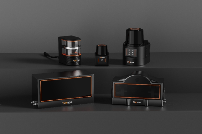
with KIGIS® LiDAR Solutions
What is LiDAR?
LiDAR stands for Light Detection and Ranging, a remote sensing method that uses light in the form of a pulsed laser to measure variable distances to the Earth.
This technology involves emitting laser beams towards an object and then calculating the time it takes for the reflected light to return to the receiver. By measuring this time delay, LiDAR systems can accurately determine the distance to an object, which, when combined with position data, enables the creation of precise, three-dimensional information about the shape and surface characteristics of the object.
The History and Development of LiDAR
The origins of LiDAR date back to the early 1960s, shortly after the invention of the laser.
Initially utilized in meteorology to measure clouds and in astronomy to calculate the distance to the moon, LiDAR technology has significantly evolved over the decades. Its applications have expanded across various fields, demonstrating its versatility and adaptability. From its early use in scientific research, LiDAR has grown to become integral in topographical mapping, forestry management, and has recently seen a surge in use within autonomous vehicle navigation systems, urban planning, and renewable energy projects. This evolution reflects ongoing advancements in laser technology, data processing capabilities, and the increasing integration of LiDAR data with other geospatial data sources.
Technology
Light Source and Detection Technology
The cornerstone of LiDAR technology is its sophisticated light source and detection system, primarily centered around laser technology.
These lasers can emit thousands of pulses per second, capable of capturing high-resolution data over vast areas with remarkable accuracy. The choice of laser wavelength can vary depending on the application, from visible light to near-infrared, each offering unique advantages in terms of reflectivity and penetration capabilities. Once the laser pulse is reflected off a surface, the system's detector – often a highly sensitive photodetector – captures the return signal. Advanced signal processing algorithms then interpret these signals to extract accurate distance measurements, enabling detailed 3D representations of the scanned area.
Time of Flight (TOF) and Phase Shift Methods
The Time of Flight (TOF) method, a fundamental principle in LiDAR technology, calculates distance by measuring the time it takes for a laser pulse to travel to an object and back.
This method's precision is paramount in applications requiring high detail, such as environmental monitoring and precision agriculture. Alternatively, the Phase Shift method offers a different approach by measuring the change in phase of the laser light as it reflects back to the sensor. This method is particularly useful for continuous scanning applications, such as industrial process control and architectural modeling, where speed and efficiency are crucial. Both methods provide unique advantages, allowing LiDAR systems to be tailored to a wide range of applications.
-
Advantages and Limitations of LiDAR
High Resolution and Precision
One of LiDAR's most significant advantages is its ability to produce data with unparalleled resolution and precision.
This capability enables the detailed mapping of surface features, even under dense vegetation, making it indispensable for geological surveying, archaeology, and environmental studies. The precision of LiDAR extends to the ability to detect minute changes in elevation, crucial for flood risk assessment, landslide monitoring, and infrastructure development.
-
Applicability in Various Environments
LiDAR technology's versatility allows it to perform under a wide range of environmental conditions.
Its ability to operate in low light or complete darkness makes it invaluable for nighttime operations, while its resilience to certain atmospheric conditions enables reliable data collection when other methods might fail.
However, LiDAR systems can be impeded by heavy rain, fog, or dust, which can scatter the laser pulses and reduce measurement accuracy.
-
Challenges and Limitations
Despite its many advantages, LiDAR technology is not without its challenges.
The cost of high-end LiDAR systems can be prohibitive for some applications, although ongoing technological advancements are gradually reducing these costs.
Additionally, the vast amounts of data generated by LiDAR can pose significant processing and storage demands, requiring robust computing resources.
The technology's performance can also be hindered by highly reflective or absorptive surfaces, which can distort the accuracy of distance measurements.
Industrial Applications of LiDAR

01
Smart Factories and Robotics
In the realm of smart manufacturing and robotics, LiDAR technology is revolutionizing how machines perceive and interact with their environment.
By providing high-resolution spatial data, LiDAR enables robots to navigate complex environments, optimize logistics, and perform intricate tasks with high precision. This has profound implications for manufacturing efficiency, safety, and the development of intelligent autonomous systems.
02
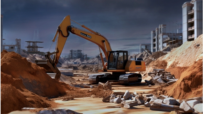
Construction and Infrastructure Management
The construction industry benefits immensely from LiDAR's ability to quickly and accurately capture the dimensions and details of sites and structures. This facilitates precise planning, monitoring, and maintenance of infrastructure, ensuring projects are completed on time and within budget.
LiDAR's contribution to infrastructure management extends to the monitoring of bridges, roads, and utilities, aiding in the early detection of potential issues and the planning of maintenance activities to ensure long-term structural integrity.
03
Other Applications
(Security, Agriculture, Aerial Surveying, etc.)
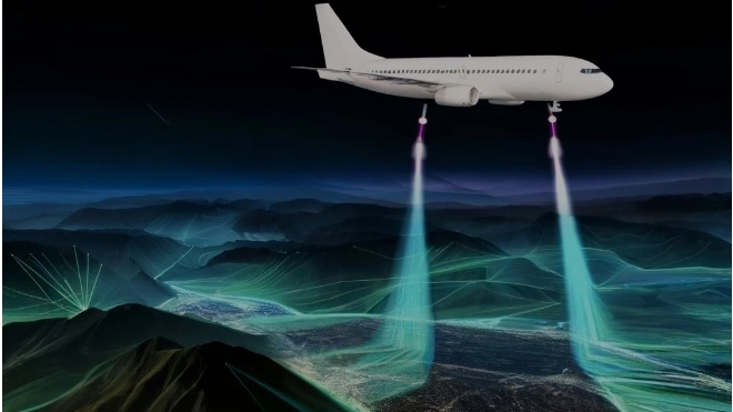
Beyond industrial settings, LiDAR's applications span various sectors. In security, it enhances perimeter monitoring and intrusion detection systems. In agriculture, it supports precision farming practices by providing detailed topographic and crop data, enabling optimized irrigation, planting, and resource management. Aerial surveying with LiDAR transforms how large-scale land and resource management projects are conducted, offering detailed terrain and vegetation data crucial for environmental conservation, mining, and urban development projects.
Technological Trends and
Future Outlook
Current Research and Development Trends
The forefront of LiDAR research is characterized by efforts to enhance system capabilities while reducing size, cost, and power consumption.
Innovations in solid-state LiDAR, which eliminate moving parts, promise to revolutionize the technology, making it more durable, compact, and affordable.
Concurrently, the integration of LiDAR with artificial intelligence and machine learning is opening new avenues for data analysis and application, from advanced driver-assistance systems (ADAS) to dynamic environmental modeling.
Future Technology and Market Prospects
The future of LiDAR technology is bright, with its potential applications expanding into new domains.
As the technology becomes more accessible and integrated with other geospatial and sensor technologies, its impact on industries such as autonomous transportation, smart cities, and digital agriculture is expected to grow exponentially. The continued evolution of LiDAR, driven by both technological advancements and market demand, positions it as a cornerstone technology in the ongoing digital transformation of numerous industries.